And so, there we are.
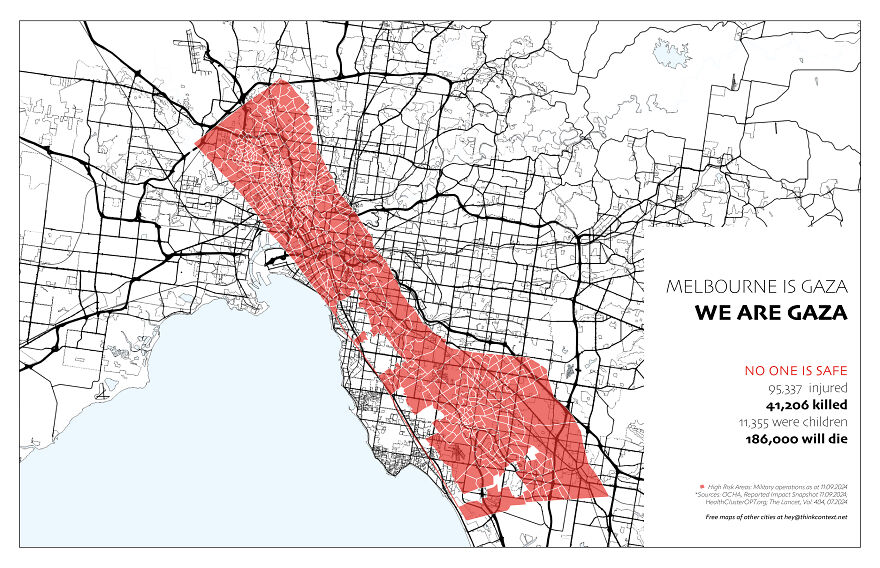
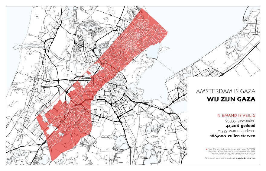
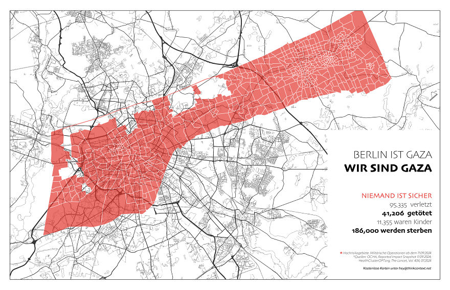
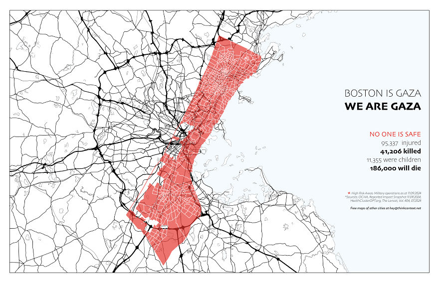
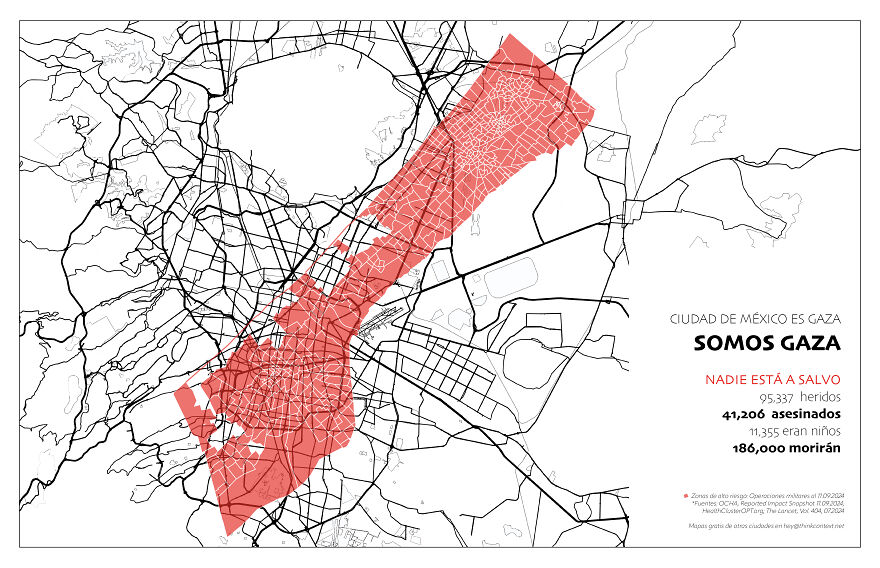
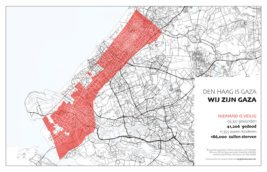
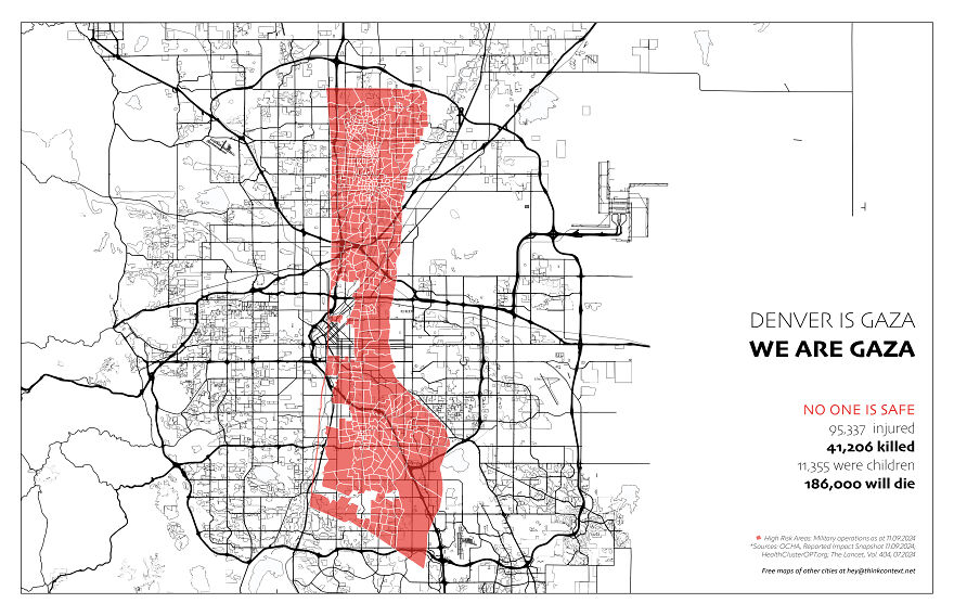
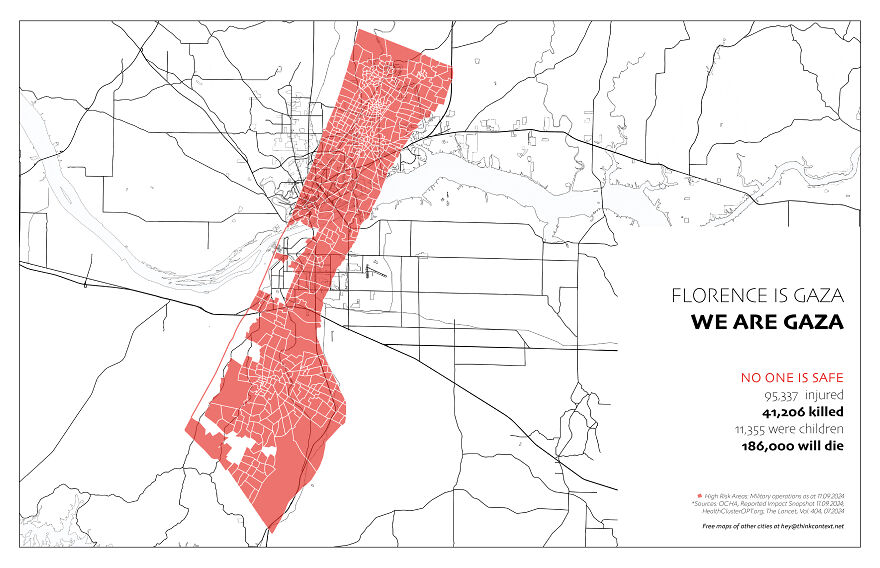
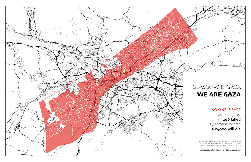
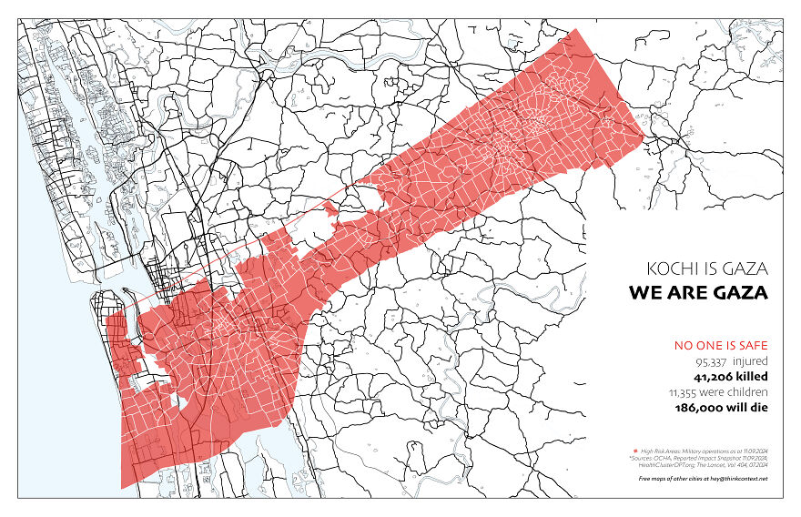
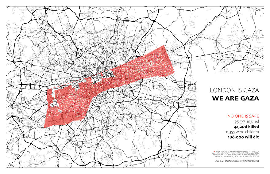
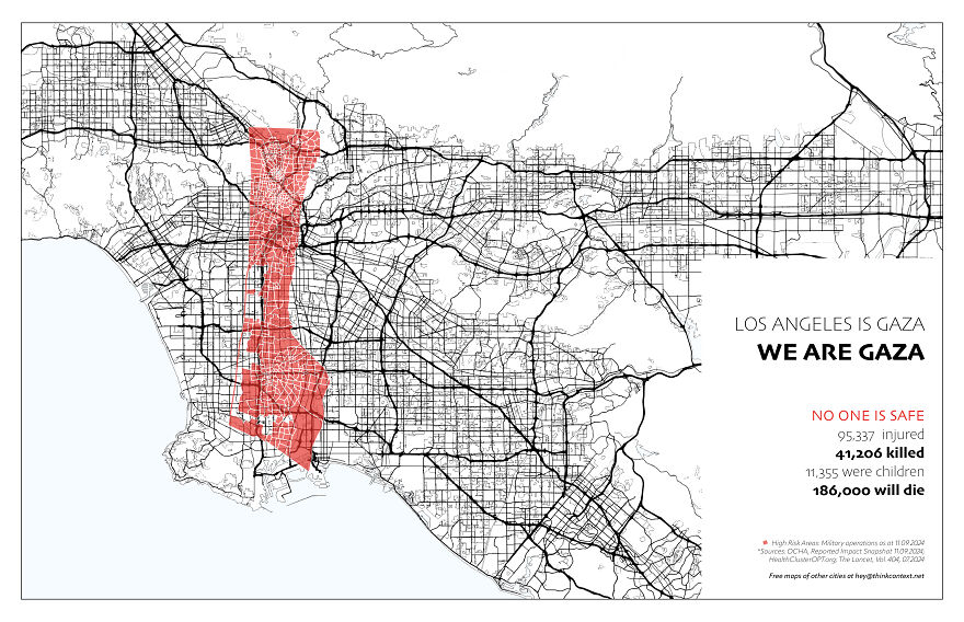
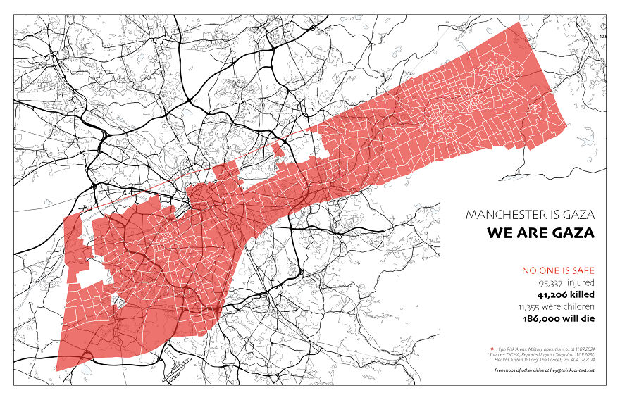
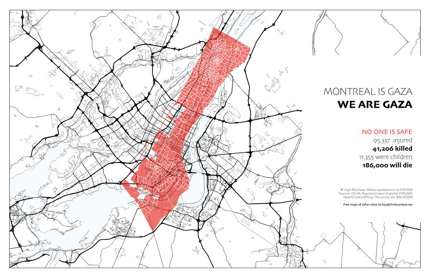
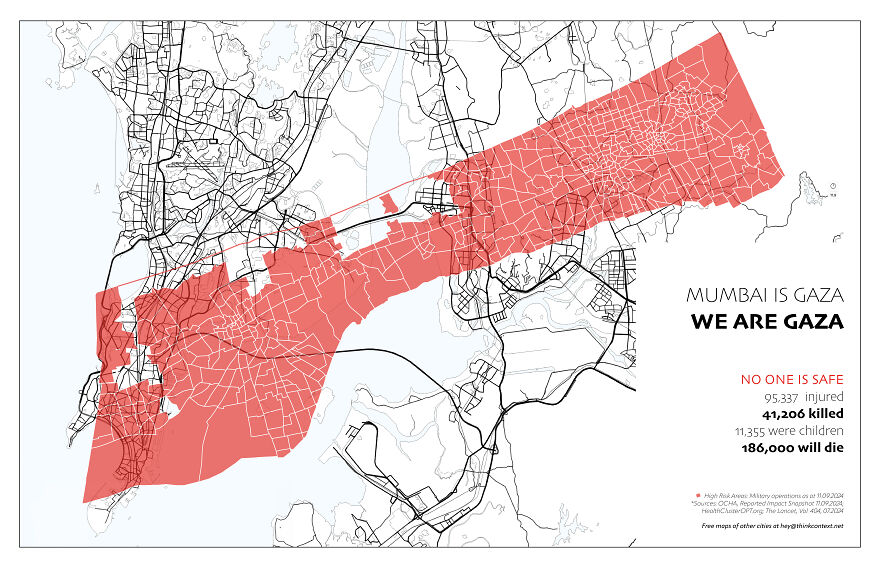
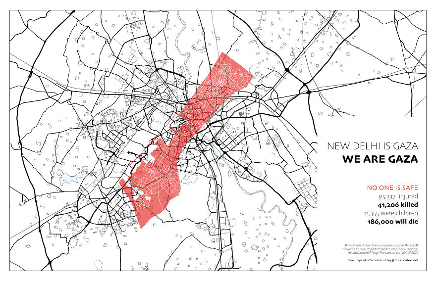
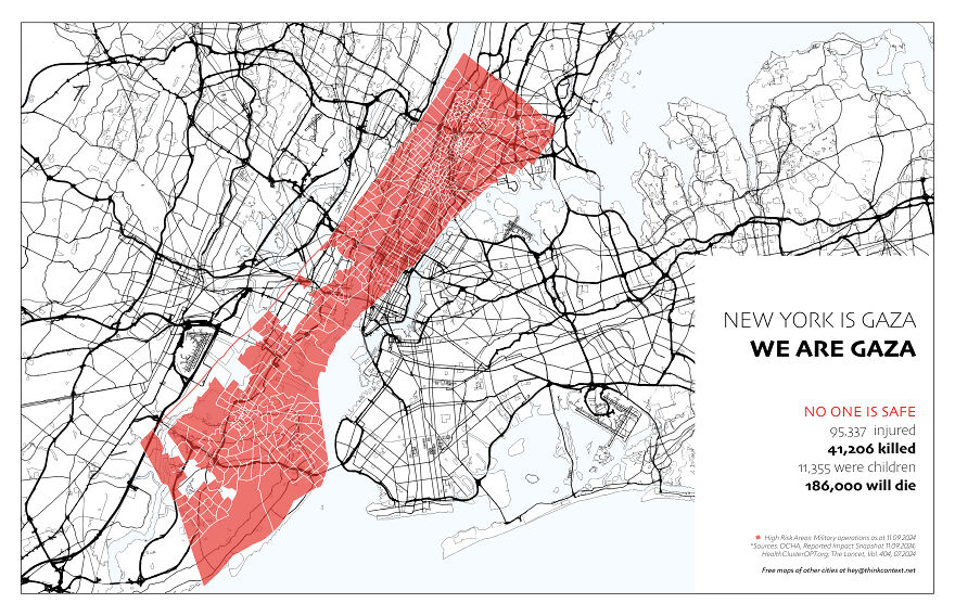
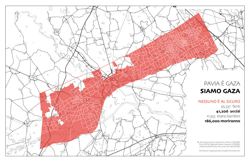
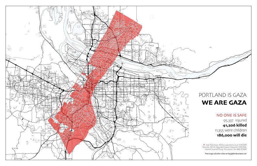
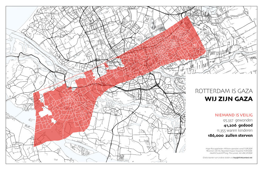
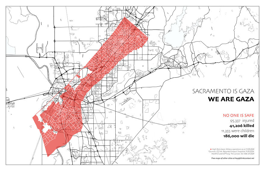
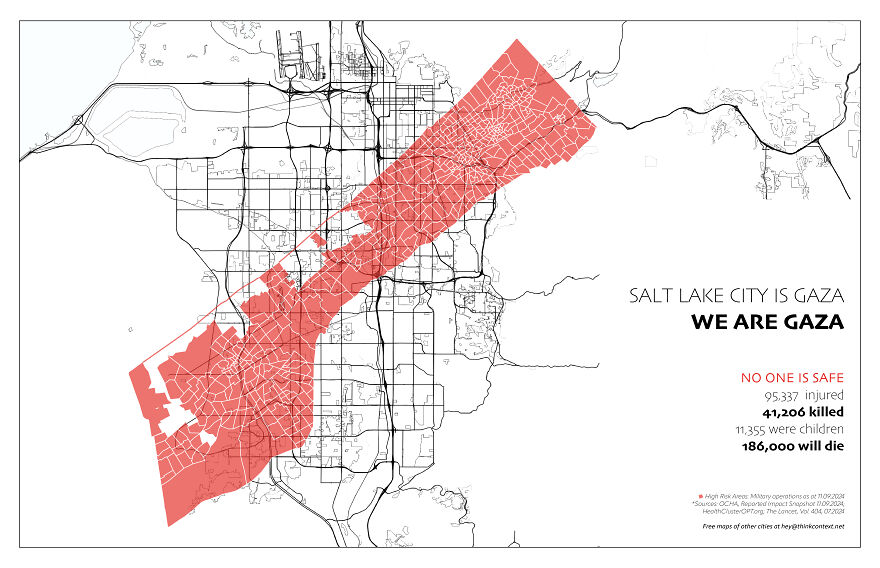
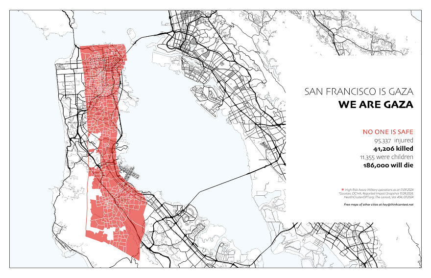
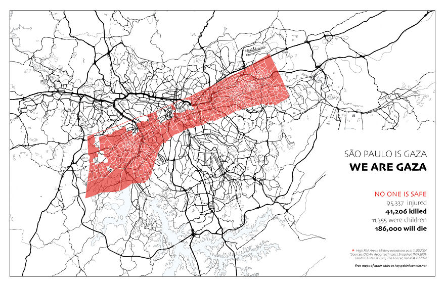
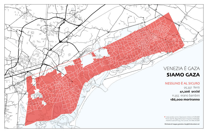
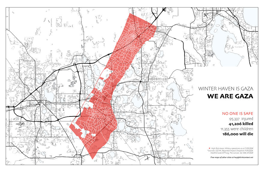
So far, I’ve created over 25 maps for people who wanted to see how Gaza compares to their cities. These maps are more than geographic overlays; they are expressions of care, compassion, and a desire to connect.
The red areas on these maps represent the territory from where the Israeli military forced Palestinians to flee and are considered highly-risk areas with ongoing military operations. What remains are the small areas in white. They are labelled ‘safe,’ though, in reality, safety is an illusion.
Overlaying Gaza onto familiar cities is a minimal gesture, but I hope it helps people understand the horrible circumstances that Palestinians face day and night. What’s happening ‘over there in Gaza’ isn’t distant from us. It’s happening wherever we are because we are all interconnected in our shared humanity.
This project is not about division. It’s about the love that binds us together, a love that, at its heart, seeks peace.
The sources for the maps are: OCHA, Reported Impact Snapshot 11.09.2024; HealthClusterOPT.org; The Lancet, Vol. 404, 07.2024 More info: thinkcontext.net Follow Bored Panda on Google News! Follow us on Flipboard.com/@boredpanda! Please use high-res photos without watermarks Ooops! Your image is too large, maximum file size is 8 MB.